

By Anna-Maria Hajba, Archivist
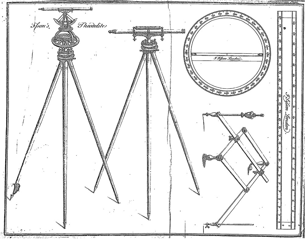
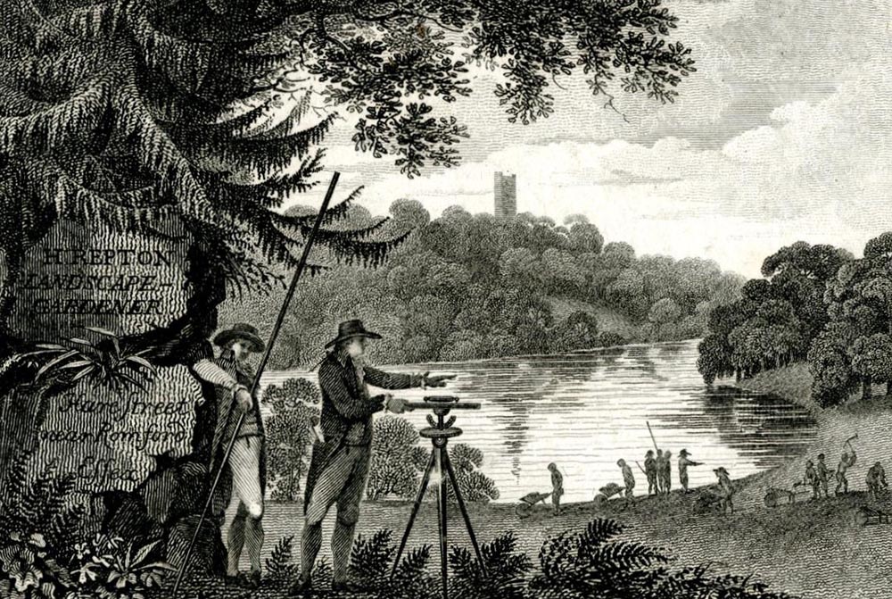
Did you ever wonder how land surveyors of the eighteenth and nineteenth centuries were able to carry out their work without drones, altitude meters, electronic distance measurement devices, ground-penetrating radar and GPS? Imagine having to use a chain made of steel wire instead of a measuring tape. Would you know how to use a circumferentor, or what to do with a plain table (not of the kitchen variety)? And yet, with what to us seems like primitive and cumbersome equipment, the surveyors of bygone days were able to produce maps that were not only extremely accurate but also aesthetically pleasing. Our new collection of two volumes of manuscript maps from County Kerry is a delightful case in point.1
Land surveys were needed for planning and construction, to establish rents according to the exact acreage of a property and to resolve boundary and other disputes over land ownership. Surveyors who carried out this work came from many walks of life. Anyone with a good grasp of mathematics and geometry and the ability to measure and record geographical data in the field could ply the trade. Army and navy officers, whose military training included the calculation of artillery ranges and other practical mathematics relevant to military operations, often found employment in this capacity, as did engineers, architects and mathematicians.
As was common at the time, dynasties of surveying families dominated the trade, with sons learning the necessary skills from their fathers and in turn passing them on to their own sons. Charles Frizell, a land surveyor in County Wexford, trained two of his sons, Charles (1738–1812) and Richard (d. 1804) in the art of land surveying, and both subsequently became leading members of their profession in eighteenth-century Ireland.2 The first of the two volumes in our Kerry Townland Maps collection was prepared by them for Dudley Ryves (d. c. 1793), agent and receiver to Francis Thomas, 3rd Earl of Kerry in the 1760s.
In addition to mapping and measuring the land, the Frizell brothers provided recommendations for its use or for suitable improvements to increase quality or productivity. To prevent flooding on the townland of Clogher following the alteration of the course of the River Brick to form the Lixnaw Canal, they recommended the construction of two sluices. This, along with the digging of ditches and drains, the Frizells assured Mr Ryves, would give him a fertile plot of ground to ‘produce large Crops of Rape & Turnips and then to sow a Crop of Barley & Grass Seeds it would make the best feeding Ground & Meadows in this Country.’

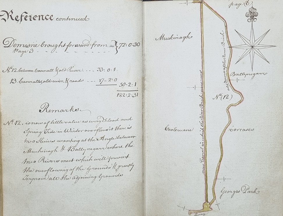
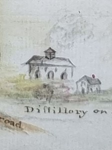
Surveyors’ maps typically contained scale bars and other geographic referencing such as north arrows, often with an elaborate fleur-de-lis marking the north position. Although Samuel Wyld, author of The Practical Surveyor (1725), emphasised that ‘the North Part of the Plott is always supposed to be placed upwards, and the East to be on the Right Hand’3, surveyors did not always follow his advice. You can see an example of this in the map above, which has to be rotated 90 degrees to the right for the orientation to be correct. The same map also has a nice example of the way local landmarks such as castles and churches were used to aid geographic orientation. In this case, a monument built by the first Earl of Kerry (1668–1741) as his intended burial place is given prominence as a local point of reference.4 A further nice detail can be found at the bottom of the image, where hands with pointed fingers indicate road directions to destinations beyond the scope of the map.
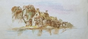
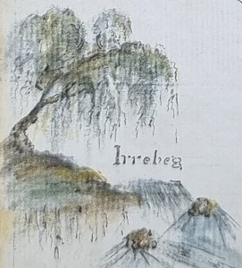

Some surveyors took the art of depicting historical or landscape features on their maps to another level. The famous French mapmaker John Rocque (c. 1704–1762) frequently included illustrations on the margins of his maps. Copied by his students, these vignettes became a popular feature of maps up to the early nineteenth century. They are also very much in evidence in our second volume of maps, prepared by an anonymous cartographer of the lands of the Earl of Listowel. Their most charming feature are the tiny sketches of rural scenes that ornament the pages, featuring churches, thatched cottages, sunsets, coastal scenes and fishermen trying their luck in the local river. They add a delightful dimension to an otherwise functional document, and provide a nostalgic reminder of bygone days when the pace of life was much slower than our own.
For those amongst you with a particular interest in maps, you might also like to take a look at the folio volume of hand-drawn maps of the estates of General Sir Eyre Coote (1726–1783) surveyed by Robert Ely in 1803 in the Coote Papers (P10); or the marvellous collection of townland maps of Counties Cork, Limerick and Tipperary in the Timothy Looney collection (P43), some of which date to the early eighteenth century. The Looney collection also contains a unique early nineteenth-century map of County Tipperary, of which you can learn more in Dr Catherine Porter’s guest post.
Related Collections:
The County Kerry Townland Map Collection (P24)
Digital scan of P24/1 (Earl of Kerry)
Digital scan of P24/2 (Earl of Listowel)
The Coote Papers (P10)
The Timothy Looney Papers (P43)
- Much of the information on land surveying and map making in this blog post has been gleaned from Finnian O’Cionnaith’s excellent book Land Surveying in Ireland, 1690-1830 (Dublin: Four Courts Press, 2022.[↩]
- For more on Charles Frizell Junior, see James Robinson, ‘Charles Frizell (1738–1812): A Surveyor in Co. Kildare’. Dublin Historical Record 58:1 (Spring 2005), pp. 2–11[↩]
- Wyld, Samuel, The Practical Surveyor, or, The Art of Land Measuring, Made Easy. London: Printed for J. Hooke and J. Sisson, 1725, p. 112.[↩]
- For more on this monument, see John Knightly’s blog post ‘Lixnaw and the Earls of Kerry.’[↩]
You must be logged in to post a comment.